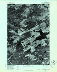
1977 Map of Lac Du Portage
USGS Topo · Published 1983About this map
The Riviere Du Portage winds through this heavily forested borderland, captured in a detailed orthophotograph just before the end of the 1970s. This aerial perspective reveals the dense timber patterns and water systems of the Maine-Quebec border region, where logging and seasonal hydrology define the landscape. Distinct water bodies like Lac Champagne and the small chain of Lacs Oliva are prominent features, surrounded by the textures of regrowth and commercial forest management. The presence of the Frost Pond Flowage and Stony Brook suggests a landscape shaped by both natural drainage and purposeful water control for the region's timber industry. For researchers, the map provides a precise visual record of the shoreline at Hall Pond and the surrounding wilderness before modern reforestation and development cycles altered the forest's composition.
Find a feature on this map
6 named features on this map. Tap any name to fly to it.
Don’t see what you’re looking for? This feature index may not catch every label — zoom into the map to look around manually.
Map Details
Editions of this 1977 Lac Du Portage Map
This is the sole edition of this map. No revisions or reprints were ever made.
Other maps of this area

1927 · Sandy Bay
USGS Topo · 1:48,000

1930 · Sandy Bay
USGS Topo · 1:62,500

1944 · Sandy Bay
USGS Topo · 1:62,500

1949 · Jackman
USGS Topo · 1:250,000

1956 · Penobscot Lake
USGS Topo · 1:62,500

1957 · Norris Brook
USGS Topo · 1:62,500

1957 · Saint Zacharie
USGS Topo · 1:62,500

1962 · Quebec
USGS Topo · 1:250,000

1963 · Jackman
USGS Topo · 1:250,000

1966 · Sherbrooke
USGS Topo · 1:250,000