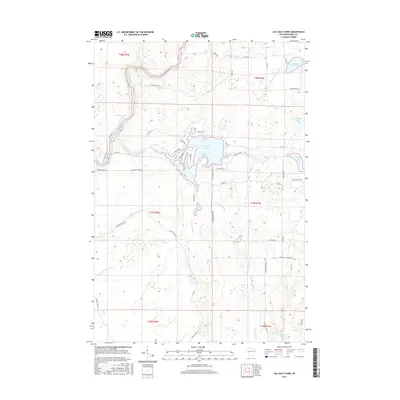
2015 Map of Lac Sault Dore
USGS Topo · Published 2015About this map
Lac Sault Dore and its intricate shoreline dominate the central geography of this Price County landscape, where the Elk River feeds into the larger reservoir system. The northern reaches are defined by the winding course of the South Fork Flambeau River, a significant waterway that snakes through the timbered terrain near Up River Rd and Power Line Rd. This 2015 data reflects a region heavily defined by its glacial hydrology and modern recreational access, with numerous named lakes like McIlquham Lake and Crane and Chase Lake punctuating the woods.
Find a feature on this map
49 named features on this map. Tap any name to fly to it.
Don’t see what you’re looking for? This feature index may not catch every label — zoom into the map to look around manually.
Map Details
Editions of this 2015 Lac Sault Dore Map
This is the sole edition of this map. No revisions or reprints were ever made.
Other maps of this area

1941 · Park Falls
USGS Topo · 1:48,000

1941 · Kennan
USGS Topo · 1:48,000

1941 · Kennedy
USGS Topo · 1:48,000

1941 · Phillips
USGS Topo · 1:48,000

1943 · Park Falls
USGS Topo · 1:48,000

1943 · Philliips
USGS Topo · 1:48,000

1945 · Kennedy
USGS Topo · 1:48,000

1945 · Kennan
USGS Topo · 1:48,000

1947 · Park Falls
USGS Topo · 1:48,000

1953 · Rice Lake
USGS Topo · 1:250,000