
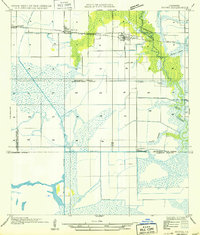
1946 Map of Lacassine
USGS Topo · Published 1946About this map
The low-lying wetlands and agricultural prairie of the Jefferson Davis Parish and Calcasieu Parish border are defined here by a complex network of man-made waterways and rail lines. The Southern Pacific and Missouri Pacific railroads serve as primary transportation arteries, with Lacassine as a focal point along U S Highway No 90. The landscape is heavily modified by drainage and irrigation projects, including the extensive Louisiana Canal, the Farmers Land and Canal Co Canal, and the Indian Bayou Canal, which support the local rice-growing economy.
Find a feature on this map
17 named features on this map. Tap any name to fly to it.
Don’t see what you’re looking for? This feature index may not catch every label — zoom into the map to look around manually.
Map Details
Editions of this 1946 Lacassine Map
This is the sole edition of this map. No revisions or reprints were ever made.
Other maps of this area

1932 · Lake Charles NE
USGS Topo · 1:31,680

1932 · Lake Charles SE
USGS Topo · 1:31,680

1942 · Lake Charles
USGS Topo · 1:62,500

1946 · Hayes
USGS Topo · 1:31,680

1947 · Fenton
USGS Topo · 1:31,680

1947 · Thornwell
USGS Topo · 1:31,680

1947 · Hecker
USGS Topo · 1:31,680

1947 · Pine Island
USGS Topo · 1:31,680

1947 · Welsh
USGS Topo · 1:31,680
1949 · Hayes
USGS Topo · 1:31,680