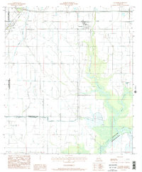
1985 Map of Lacassine
USGS Topo · Published 1985About this map
Lacassine and Iowa anchor this 1980s landscape, where the flat coastal plains of Louisiana are defined by an intricate network of water management. The map reveals how the natural flow of West Bayou Lacassine and Lacassine Bayou is supplemented by a grid of engineered waterways, including the Louisiana Canal, Niblett Canal, and Doucet Canal. This infrastructure supports the region's agricultural character, woven between the established tracks of the Southern Pacific and Missouri Pacific railroads.
Find a feature on this map
21 named features on this map. Tap any name to fly to it.
Don’t see what you’re looking for? This feature index may not catch every label — zoom into the map to look around manually.
Map Details
Editions of this 1985 Lacassine Map
2 editions found
Other maps of this area

1932 · Lake Charles NE
USGS Topo · 1:31,680

1932 · Lake Charles SE
USGS Topo · 1:31,680

1942 · Lake Charles
USGS Topo · 1:62,500

1946 · Lacassine
USGS Topo · 1:31,680

1946 · Hayes
USGS Topo · 1:31,680

1947 · Fenton
USGS Topo · 1:31,680

1947 · Thornwell
USGS Topo · 1:31,680

1947 · Hecker
USGS Topo · 1:31,680

1947 · Pine Island
USGS Topo · 1:31,680

1947 · Welsh
USGS Topo · 1:31,680