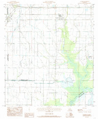
1985 Map of Lacassine
USGS Topo · Published 1985About this map
Agricultural water management and rail transportation define this portion of the coastal prairie during the mid-1980s. The landscape is dominated by an intricate network of irrigation ditches, flumes, and siphons that support the local rice-farming economy, centered on the communities of Iowa and Lacassine. The southern half of the sheet reveals the complex hydrology of the region, where the Indian Bayou Canal and Lacassine Bayou snake through wetlands. A Pumping Station near Verret underscores the engineering required to manage these low-lying lands. Transport is anchored by the parallel lines of the Southern Pacific and Missouri Pacific railroads, which bypass the marshes to the north. Smaller details, such as a Cem and a Boat Dock, provide specific points of interest for genealogists and local historians tracking the development of Jefferson Davis and Calcasieu Parishes.
Find a feature on this map
17 named features on this map. Tap any name to fly to it.
Don’t see what you’re looking for? This feature index may not catch every label — zoom into the map to look around manually.
Map Details
Editions of this 1985 Lacassine Map
2 editions found
Other maps of this area

1932 · Lake Charles NE
USGS Topo · 1:31,680

1932 · Lake Charles SE
USGS Topo · 1:31,680

1942 · Lake Charles
USGS Topo · 1:62,500

1946 · Lacassine
USGS Topo · 1:31,680

1946 · Hayes
USGS Topo · 1:31,680

1947 · Fenton
USGS Topo · 1:31,680

1947 · Thornwell
USGS Topo · 1:31,680

1947 · Hecker
USGS Topo · 1:31,680

1947 · Pine Island
USGS Topo · 1:31,680

1947 · Welsh
USGS Topo · 1:31,680