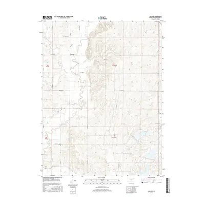
2015 Map of Laclede
USGS Topo · Published 2015About this map
Vermillion Cr winds through this section of Pottawatomie County, where the historic path of the Oregon Trail Rd remains a visible marker of westward migration. Near the southern edge of the sheet, the Vieux Cem stands as a quiet witness to the families and travelers who passed through this corridor. The small settlement of Laclede serves as a local hub, surrounded by a network of drainage systems including Pomeroy Cr, Polly Cr, and Lost Cr.
Find a feature on this map
37 named features on this map. Tap any name to fly to it.
Don’t see what you’re looking for? This feature index may not catch every label — zoom into the map to look around manually.
Map Details
Editions of this 2015 Laclede Map
This is the sole edition of this map. No revisions or reprints were ever made.
Other maps of this area

1889 · Wamego
USGS Topo · 1:125,000

1894 · Wamego
USGS Topo · 1:125,000

1953 · Wamego
USGS Topo · 1:24,000

1953 · Belvue
USGS Topo · 1:24,000

1953 · St Marys
USGS Topo · 1:24,000

1955 · Manhattan
USGS Topo · 1:250,000

1956 · Manhattan
USGS Topo · 1:250,000

1957 · Manhattan
USGS Topo · 1:250,000
1964 · Louisville
USGS Topo · 1:24,000
1964 · Onaga NE
USGS Topo · 1:24,000