
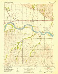
1953 Map of Belvue
USGS Topo · Published 1954About this map
The Union Pacific railroad corridor anchors the small settlement of Belvue in this mid-century survey of the Kansas River valley. Spanning the border of Pottawatomie and Wabaunsee Counties, the landscape is defined by the winding course of the Kansas River and its varied tributaries, including Vermillion Creek and the man-made Wamego Diversion Channel. Rural life is meticulously documented through a network of country schools and churches that served the surrounding agricultural community. Geocoded landmarks such as Wells Creek Sch, Arand Sch, and Greenwood Sch are captured alongside the St Johns Ch and its namesake St Johns Cem. The terrain rises from the river bottoms into the southern hills, where the Community Hall and Wells Creek Ch stand near the headwaters of Wells Creek, reflecting the established social and spiritual geography of the early 1950s.
Find a feature on this map
19 named features on this map. Tap any name to fly to it.
Don’t see what you’re looking for? This feature index may not catch every label — zoom into the map to look around manually.
Map Details
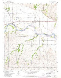
Editions of this 1953 Belvue Map
3 editions found
Other maps of this area

1889 · Wamego
USGS Topo · 1:125,000

1894 · Wamego
USGS Topo · 1:125,000

1953 · Wamego
USGS Topo · 1:24,000

1953 · Maple Hill
USGS Topo · 1:24,000

1953 · St Marys
USGS Topo · 1:24,000

1954 · Alma
USGS Topo · 1:24,000

1954 · Mc Farland
USGS Topo · 1:24,000

1955 · Manhattan
USGS Topo · 1:250,000

1956 · Manhattan
USGS Topo · 1:250,000

1957 · Manhattan
USGS Topo · 1:250,000