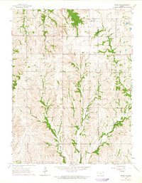
1964 Map of Onaga NE
USGS Topo · Published 1965About this map
The Old Indian Treaty Boundary slices across this rural landscape, a significant historical line separating the townships of Lincoln and Grant. This mid-century survey captures a transition in the Kansas countryside where agricultural land use and limestone extraction coincide. Several Quarries are scattered throughout the center of the sheet, indicating the local importance of the stone industry alongside traditional farming. The area is defined by a dense network of watercourses, including the convergence of Big Noxie Creek and Little Noxie Creek, which drain south toward the boundary of Adrian. Local landmarks such as Fairview Cem and Bucks Grove Ch serve as focal points for the surrounding rural communities. To the northeast, the Riley Lakes provide a rare departure from the stream-fed valleys that dominate the terrain of Pottawatomie and Jackson counties.
Find a feature on this map
17 named features on this map. Tap any name to fly to it.
Don’t see what you’re looking for? This feature index may not catch every label — zoom into the map to look around manually.
Map Details
Editions of this 1964 Onaga NE Map
This is the sole edition of this map. No revisions or reprints were ever made.
Other maps of this area

1888 · Hiawatha
USGS Topo · 1:125,000

1889 · Seneca
USGS Topo · 1:125,000

1889 · Wamego
USGS Topo · 1:125,000

1889 · Topeka
USGS Topo · 1:125,000

1894 · Seneca
USGS Topo · 1:125,000

1894 · Topeka
USGS Topo · 1:125,000

1894 · Hiawatha
USGS Topo · 1:125,000

1894 · Wamego
USGS Topo · 1:125,000

1950 · Kansas City
USGS Topo · 1:250,000

1954 · Kansas City
USGS Topo · 1:250,000