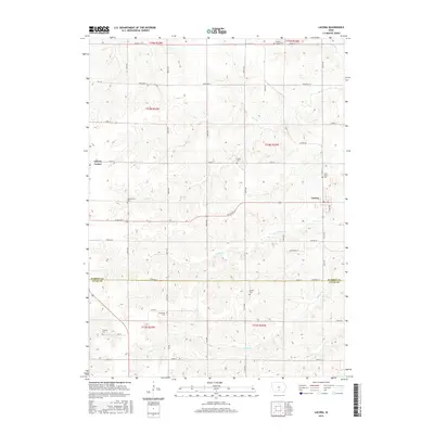
2015 Map of Lacona
USGS Topo · Published 2015About this map
Lacona and Liberty Center anchor this agricultural landscape along the southern border of Warren and Lucas Counties. The map reveals a high density of rural burial grounds, including Saint Mary's Cem and Goodes Chapel Cem, providing essential markers for family historians tracing early Iowa lineage. The drainage pattern is defined by the winding paths of Wolf Cr, Cotton Cr, and Stony Cr, which cut through the township sections and shape the placement of the grid road network. Significant corridors like Hwy 65 and Co Rd G76 intersect the terrain, connecting the small town center of Lacona to the broader prairie landscape. The numerous cemeteries such as Arnold Cem and Fletcher Cem suggest long-established rural congregations and family homesteads that have persisted since the early days of settlement.
Find a feature on this map
35 named features on this map. Tap any name to fly to it.
Don’t see what you’re looking for? This feature index may not catch every label — zoom into the map to look around manually.
Map Details
Editions of this 2015 Lacona Map
This is the sole edition of this map. No revisions or reprints were ever made.
Other maps of this area

1910 · Milo
USGS Topo · 1:62,500

1918 · Chariton
USGS Topo · 1:62,500

1931 · Indianola
USGS Topo · 1:62,500

1950 · New Virginia
USGS Topo · 1:62,500

1952 · New Virginia
USGS Topo · 1:62,500

1954 · Des Moines
USGS Topo · 1:250,000

1956 · Des Moines
USGS Topo · 1:250,000

1957 · Des Moines
USGS Topo · 1:250,000

1965 · Milo
USGS Topo · 1:24,000
1965 · Beech
USGS Topo · 1:24,000