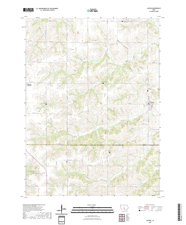
2022 Map of Lacona
USGS Topo · Published 2022About this map
Lacona and the neighboring community of Liberty Center anchor this rural landscape along the southern border of Warren and Lucas counties. The terrain is defined by the branching drainages of Wolf Creek, Cotton Creek, and Stony Creek, which create a complex network of ridges and draws across the prairie. For those documenting family history, the map provides precise locations for several local burial grounds, including Saint Marys of Lacona Cemetery and Plainville-Chapel Cemetery in the north, and Graceland Cemetery further south. The geometric grid of rural roads, such as Wyoming Street and County Road G76, reveals a landscape still primarily dedicated to agriculture, where early pioneer settlements have left their mark through persistent place names and small, scattered cemeteries like Hendrickson Cem and Shupe Cem.
Find a feature on this map
46 named features on this map. Tap any name to fly to it.
Don’t see what you’re looking for? This feature index may not catch every label — zoom into the map to look around manually.
Map Details
Editions of this 2022 Lacona Map
This is the sole edition of this map. No revisions or reprints were ever made.
Other maps of this area

1910 · Milo
USGS Topo · 1:62,500

1918 · Chariton
USGS Topo · 1:62,500

1931 · Indianola
USGS Topo · 1:62,500

1950 · New Virginia
USGS Topo · 1:62,500

1952 · New Virginia
USGS Topo · 1:62,500

1954 · Des Moines
USGS Topo · 1:250,000

1956 · Des Moines
USGS Topo · 1:250,000

1957 · Des Moines
USGS Topo · 1:250,000

1965 · Milo
USGS Topo · 1:24,000
1965 · Beech
USGS Topo · 1:24,000