
Loading...
Loading map...2024 Map of Laconia
USGS Topo · Published 2024About this map
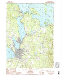
The Laconia landscape is defined by the intricate relationship between its urban centers and the expansive waters of Lake Winnipesaukee, Paugus Bay, and Lake Winnisquam. In the central city, civic life centers around the Belknap County Courthouse and Lakes Region Community College, while historical burial grounds like Meredith Bridge Cem and Saint Lamberts Cem offer a window into generations of local families.
Find a feature on this map
171 named features on this map. Tap any name to fly to it.
Don’t see what you’re looking for? This feature index may not catch every label — zoom into the map to look around manually.
Map Details
Date Portrayed2024
Date Published2024
PublisherU.S. Geological Survey
Map TypeTopographic
Scale1:24000
Physical Dimensions24 x 29 inches
Editions of this 2024 Laconia Map
This is the sole edition of this map. No revisions or reprints were ever made.
Historical Maps of Quinby Point Through Time
Featured Locations
Source Details
SourceU.S. Geological Survey
CopyrightPublic Domain