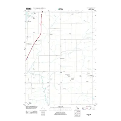
2011 Map of Lacota
USGS Topo · Published 2011About this map
The eastern shore of Lake Michigan defines the western edge of this region, where the high bluffs of Cedar Bluff and Hollywood overlook the water. Moving inland, the landscape is shaped by the complex drainage of the North Branch Black River, Middle Branch Black River, and South Branch Black River, which converge in a rural agricultural patchwork. Small settlements such as Lacota and Kibbie serve as local hubs, with the Lacota Post Office and several family-named burial grounds, including Stephenson Cemetery and McDowell Cemetery, providing essential links for genealogists and local historians. This era shows a mix of traditional land use and modern recreation, featuring the Gingerman Raceway and the Kal Haven Trl, a recreational path following a former rail corridor. Scattered landing strips like the Sanko Landing Strip and Trowbridge Farms Airport suggest the persistence of private aviation in this corner of Van Buren County.
Find a feature on this map
56 named features on this map. Tap any name to fly to it.
Don’t see what you’re looking for? This feature index may not catch every label — zoom into the map to look around manually.
Map Details
Editions of this 2011 Lacota Map
This is the sole edition of this map. No revisions or reprints were ever made.
Other maps of this area

1927 · Bangor
USGS Topo · 1:62,500

1927 · South Haven
USGS Topo · 1:62,500

1928 · Fennville
USGS Topo · 1:62,500

1930 · South Haven
USGS Topo · 1:62,500

1931 · Fennville
USGS Topo · 1:62,500

1931 · Bangor
USGS Topo · 1:62,500

1943 · South Haven
USGS Topo · 1:62,500

1943 · Bangor
USGS Topo · 1:62,500

1958 · Racine
USGS Topo · 1:250,000

1962 · Racine
USGS Topo · 1:250,000
Featured Places
- South Haven, MI
- Geneva Township, MI
- Maple Grove Corners, MI
- Glenn Haven Shores, MI
- South Haven Charter Township, MI