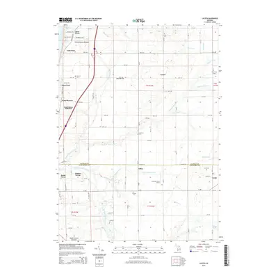
2014 Map of Lacota
USGS Topo · Published 2014About this map
The eastern shore of Lake Michigan defines the western edge of this landscape, where coastal communities like Glenn Haven Shores and Miami Park give way to an agricultural interior. The boundary between Allegan and Van Buren Counties bisects the area, following Baseline Rd past the settlement of Kibbie. The drainage patterns are defined by the branching tributaries of the Black River, including the North Branch Black River, the Middle Br Black River, and the South Branch Black River, which carve through the land alongside engineered waterways like the Tripp and Extension Drain.
Find a feature on this map
62 named features on this map. Tap any name to fly to it.
Don’t see what you’re looking for? This feature index may not catch every label — zoom into the map to look around manually.
Map Details
Editions of this 2014 Lacota Map
This is the sole edition of this map. No revisions or reprints were ever made.
Other maps of this area

1927 · Bangor
USGS Topo · 1:62,500

1927 · South Haven
USGS Topo · 1:62,500

1928 · Fennville
USGS Topo · 1:62,500

1930 · South Haven
USGS Topo · 1:62,500

1931 · Fennville
USGS Topo · 1:62,500

1931 · Bangor
USGS Topo · 1:62,500

1943 · South Haven
USGS Topo · 1:62,500

1943 · Bangor
USGS Topo · 1:62,500

1958 · Racine
USGS Topo · 1:250,000

1962 · Racine
USGS Topo · 1:250,000
Featured Places
- South Haven, MI
- Geneva Township, MI
- Maple Grove Corners, MI
- Glenn Haven Shores, MI
- South Haven Charter Township, MI