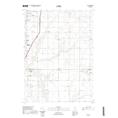
2019 Map of Lacota
USGS Topo · Published 2019About this map
The Middle Br Black River and South Branch Black River converge in this agricultural landscape spanning the Allegan Co and Van Buren Co border. Small, long-established settlements such as Kibbie, Hawkhead, and Lacota anchor the rural crossroads, many of which are marked by family-named burial sites like Stephenson Cem and Stuller Cem. The transition from the rural interior toward the lakeside is evident in the residential clusters of Hollywood, Cedar Bluff, and Miami Park. A significant landmark of the region's recreational evolution is the Kal-Haven Trail State Park, which follows a former rail corridor through the heart of the territory. This 2019 survey documents the enduring layout of orchard-rich southwestern Michigan, where traditional township-and-range lines dictated by t1n r16w meet the expanding outskirts of South Haven.
Find a feature on this map
68 named features on this map. Tap any name to fly to it.
Don’t see what you’re looking for? This feature index may not catch every label — zoom into the map to look around manually.
Map Details
Editions of this 2019 Lacota Map
This is the sole edition of this map. No revisions or reprints were ever made.
Other maps of this area

1927 · Bangor
USGS Topo · 1:62,500

1927 · South Haven
USGS Topo · 1:62,500

1928 · Fennville
USGS Topo · 1:62,500

1930 · South Haven
USGS Topo · 1:62,500

1931 · Fennville
USGS Topo · 1:62,500

1931 · Bangor
USGS Topo · 1:62,500

1943 · South Haven
USGS Topo · 1:62,500

1943 · Bangor
USGS Topo · 1:62,500

1958 · Racine
USGS Topo · 1:250,000

1962 · Racine
USGS Topo · 1:250,000
Featured Places
- South Haven, MI
- Geneva Township, MI
- Maple Grove Corners, MI
- Glenn Haven Shores, MI
- South Haven Charter Township, MI