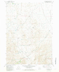
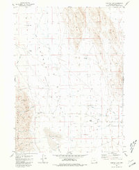
1981 Map of Ladycomb Peak
USGS Topo · Published 1981About this map
Ladycomb Peak stands as the central landmark in this high-desert landscape of Harney County, where the steep terrain of the Pueblo Mountains drops away into the Pueblo Valley. The map records a sparse but resilient history of ranching and prospecting through the late twentieth century. Family names are etched into the geography at the McDade Ranch and the isolated McLean Cabin, while several former homesites are identified only as remnants, including the Starr Homestead (Ruins), Roux Place (Ruins), and Oleachea Place (Ruins). These sites, along with the Stergen Cabin near the falls of Little Willow Creek, suggest a pattern of seasonal habitation tied to the scarce water of Arizona Creek and numerous unnamed springs. Evidence of mineral exploration appears on the eastern slopes at the Rabbit Hole Mine and scattered prospects.
Find a feature on this map
33 named features on this map. Tap any name to fly to it.
Don’t see what you’re looking for? This feature index may not catch every label — zoom into the map to look around manually.
Map Details
Editions of this 1981 Ladycomb Peak Map
2 editions found
Other maps of this area

1955 · Adel
USGS Topo · 1:250,000

1957 · Adel
USGS Topo · 1:250,000

1958 · Adel
USGS Topo · 1:250,000

1962 · Adel
USGS Topo · 1:250,000

1971 · Fields Basin
USGS Topo · 1:24,000

1971 · Fields
USGS Topo · 1:24,000

1971 · Borax Lake
USGS Topo · 1:24,000
1981 · Colony Ranch
USGS Topo · 1:24,000
1981 · Van Horn Basin
USGS Topo · 1:24,000
1981 · Tumtum Lake
USGS Topo · 1:24,000