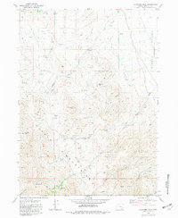
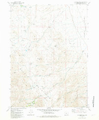
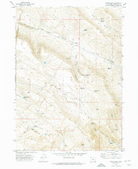
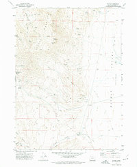
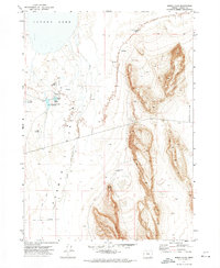
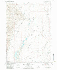
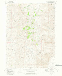
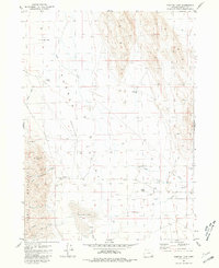
1981 Map of Ladycomb Peak
USGS Topo · Published 1983About this map
Ladycomb Peak stands as the central landmark in this high-desert region of Harney County, where the southern reaches of the Pueblo Mountains overlook the Pueblo Valley. This late-twentieth-century survey documents a landscape defined by isolated homesteading and seasonal water management, featuring several sites in decay such as the Starr Homestead, Roux Place, and Oleachea Place. The importance of the local watershed is evident in the numerous Springs and named drainages like Little Willow Creek and Sesena Creek that support ranching operations at McDade Ranch. Remnants of earlier mineral exploration appear at the Rabbit Hole Mine and various Prospects, while high-altitude passes like Oleachea Pass and remote shelters like Stergen Cabin or McLean Cabin illustrate the sparse but deliberate human footprint in this corner of the Great Basin.
Find a feature on this map
32 named features on this map. Tap any name to fly to it.
Don’t see what you’re looking for? This feature index may not catch every label — zoom into the map to look around manually.
Map Details
Editions of this 1981 Ladycomb Peak Map
2 editions found
Other maps of this area

1955 · Adel
USGS Topo · 1:250,000

1957 · Adel
USGS Topo · 1:250,000

1958 · Adel
USGS Topo · 1:250,000

1962 · Adel
USGS Topo · 1:250,000
1971 · Fields Basin
USGS Topo · 1:24,000
1971 · Fields
USGS Topo · 1:24,000
1971 · Borax Lake
USGS Topo · 1:24,000
1981 · Colony Ranch
USGS Topo · 1:24,000
1981 · Van Horn Basin
USGS Topo · 1:24,000
1981 · Tumtum Lake
USGS Topo · 1:24,000