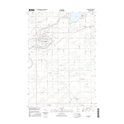
2015 Map of Ladysmith
USGS Topo · Published 2015About this map
The Flambeau River defines the landscape of Rusk County in this 2015 survey, winding through the city of Ladysmith and creating the Ladysmith Flowage as it passes the town center. The industrial and civic heart of the county is visible here, anchored by the Rusk County Airport and the village of Tony to the east. The river's path is marked by recreational and historical points, from the Dairyland Reservoir with its curiously named Bunyans Hat Island to the quiet waters of Corbett Lake. Numerous local burial grounds, such as Riverside Cem and the Old Ladysmith Cem, provide significant touchstones for genealogists studying the families of the Upper Chippewa Valley. To the south, the settlement of Conrath sits near the banks of Main Creek, illustrating the spread of small-town development along the region's smaller tributaries like Deer Tail Cr and Skunk Cr.
Find a feature on this map
74 named features on this map. Tap any name to fly to it.
Don’t see what you’re looking for? This feature index may not catch every label — zoom into the map to look around manually.
Map Details
Editions of this 2015 Ladysmith Map
This is the sole edition of this map. No revisions or reprints were ever made.
Other maps of this area

1944 · Exeland
USGS Topo · 1:48,000

1945 · Ingram
USGS Topo · 1:48,000

1947 · Exeland
USGS Topo · 1:48,000

1947 · Ingram
USGS Topo · 1:48,000

1947 · Sheldon
USGS Topo · 1:48,000

1948 · Ladysmith
USGS Topo · 1:48,000

1949 · Sheldon
USGS Topo · 1:48,000

1950 · Ladysmith
USGS Topo · 1:48,000

1953 · Rice Lake
USGS Topo · 1:250,000

1959 · Rice Lake
USGS Topo · 1:250,000