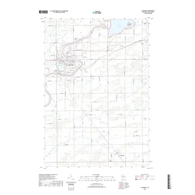
2018 Map of Ladysmith
USGS Topo · Published 2018About this map
Ladysmith sits along the bend of the Flambeau River, serving as the heart of Rusk County's landscape in this modern era. The river’s path is well-defined by industrial and municipal development, flowing past Corbett Lake and several regional landmarks including the Servants of Mary Cem and Old Ladysmith Cem. North of the city, the Dairyland Reservoir dominates the drainage basin, featuring the distinctly named Bunyans Hat Island and Groothousen Bay. To the east and south, the settlements of Tony and Conrath maintain their presence along the local transportation network. The landscape beyond the river corridor is organized into a rigid grid of rural routes like Falcon Ave and Old Airport Rd, reflecting the area's agricultural and forestry heritage. Genealogists will find interest in the multiple burial sites documented, including Riverside Cem and Holy Trinity Cem.
Find a feature on this map
113 named features on this map. Tap any name to fly to it.
Don’t see what you’re looking for? This feature index may not catch every label — zoom into the map to look around manually.
Map Details
Editions of this 2018 Ladysmith Map
This is the sole edition of this map. No revisions or reprints were ever made.
Other maps of this area

1944 · Exeland
USGS Topo · 1:48,000

1945 · Ingram
USGS Topo · 1:48,000

1947 · Exeland
USGS Topo · 1:48,000

1947 · Ingram
USGS Topo · 1:48,000

1947 · Sheldon
USGS Topo · 1:48,000

1948 · Ladysmith
USGS Topo · 1:48,000

1949 · Sheldon
USGS Topo · 1:48,000

1950 · Ladysmith
USGS Topo · 1:48,000

1953 · Rice Lake
USGS Topo · 1:250,000

1959 · Rice Lake
USGS Topo · 1:250,000