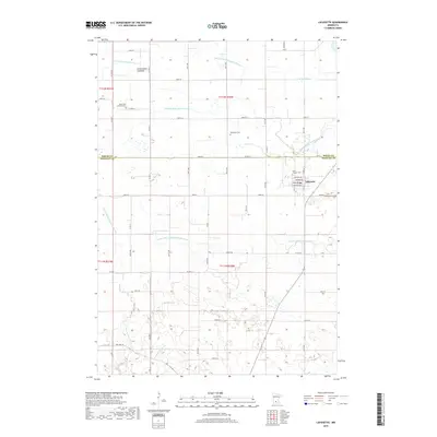
2019 Map of Lafayette
USGS Topo · Published 2019About this map
Lafayette serves as the primary hub for this portion of southern Minnesota, where the grid of rural section roads meets the managed water systems of S Br Rush River and Huelskamp Cr. The landscape is heavily defined by an intricate network of drainage systems, including Judicial Ditch Number One and County Ditch Number Seventyseven, which transformed the prairie into productive farmland. The geographic memory of the region is preserved in the Cottonwood Lakebed and historic transport routes like Old Fort Rd. For family historians, several burial grounds are scattered across the townships, including Clear Lake Lutheran Cem, Methodist Cem, and Saint Gregory Cem, marking the local heritage of the early agricultural communities near the Sibley and Nicollet county line.
Find a feature on this map
42 named features on this map. Tap any name to fly to it.
Don’t see what you’re looking for? This feature index may not catch every label — zoom into the map to look around manually.
Map Details
Editions of this 2019 Lafayette Map
This is the sole edition of this map. No revisions or reprints were ever made.
Other maps of this area

1953 · New Ulm
USGS Topo · 1:250,000

1957 · New Ulm
USGS Topo · 1:250,000

1958 · New Ulm
USGS Topo · 1:250,000

1958 · Winthrop
USGS Topo · 1:62,500

1964 · Bernadotte
USGS Topo · 1:24,000

1964 · New Ulm
USGS Topo · 1:24,000

1964 · Courtland
USGS Topo · 1:24,000

1964 · Essig
USGS Topo · 1:24,000

1964 · Lafayette
USGS Topo · 1:24,000

1964 · St George
USGS Topo · 1:24,000