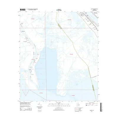
2015 Map of Lafitte
USGS Topo · Published 2015About this map
Lafitte and Barataria anchor this complex wetland landscape where the artificial engineering of the Barataria Bay Waterway meets the ancient winding channels of Bayou Rigolettes and Bayou Cutler. To the northeast, the Mississippi River forms a sharp boundary, with river-bank settlements like Jesuit Bend, Gloria, and Star following the curve of Highway 23. This 2015 perspective shows a territory defined by water management and transit, from the California County Canal in the north to the southern expanse of Bayou Dupont.
Find a feature on this map
61 named features on this map. Tap any name to fly to it.
Don’t see what you’re looking for? This feature index may not catch every label — zoom into the map to look around manually.
Map Details
Editions of this 2015 Lafitte Map
This is the sole edition of this map. No revisions or reprints were ever made.
Other maps of this area

1891 · Pointe a La Hache
USGS Topo · 1:62,500

1891 · New Orleans
USGS Topo · 1:62,500

1892 · Barataria
USGS Topo · 1:62,500

1892 · St. Bernard
USGS Topo · 1:62,500

1892 · Pointe a La Hache
USGS Topo · 1:62,500

1932 · New Orleans SE
USGS Topo · 1:31,680

1932 · New Orleans SW
USGS Topo · 1:31,680

1939 · Pointe a La Hache
USGS Topo · 1:62,500
1940 · Belle Chasse
USGS Topo · 1:31,680
1940 · Bertrandville
USGS Topo · 1:31,680