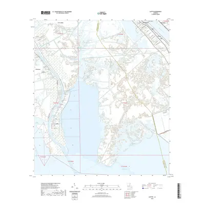
2020 Map of Lafitte
USGS Topo · Published 2020About this map
The low-lying wetlands of Jefferson Parish and Plaquemines Parish converge here, where the Mississippi River bends sharply near Wills Point. This complex hydrologic landscape is defined by its extensive network of canals and bayous, including the Barataria Bay Waterway, Fleming Canal, and Bayou Dupont. These waterways historically served as the primary transit routes for the region's fishing and maritime industries, connecting isolated settlements like Jean Lafitte and Lafitte to the Gulf.
Find a feature on this map
59 named features on this map. Tap any name to fly to it.
Don’t see what you’re looking for? This feature index may not catch every label — zoom into the map to look around manually.
Map Details
Editions of this 2020 Lafitte Map
This is the sole edition of this map. No revisions or reprints were ever made.
Other maps of this area

1891 · Pointe a La Hache
USGS Topo · 1:62,500

1891 · New Orleans
USGS Topo · 1:62,500

1892 · Barataria
USGS Topo · 1:62,500

1892 · St. Bernard
USGS Topo · 1:62,500

1892 · Pointe a La Hache
USGS Topo · 1:62,500

1932 · New Orleans SE
USGS Topo · 1:31,680

1932 · New Orleans SW
USGS Topo · 1:31,680

1939 · Pointe a La Hache
USGS Topo · 1:62,500
1940 · Belle Chasse
USGS Topo · 1:31,680
1940 · Bertrandville
USGS Topo · 1:31,680