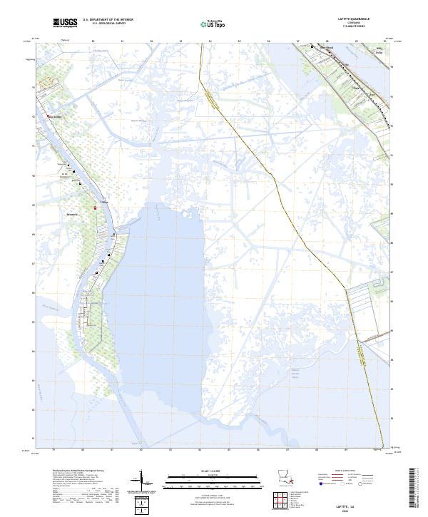
2024 Map of Lafitte
USGS Topo · Published 2024About this map
Jean Lafitte and the surrounding marshlands of the Jefferson Parish coastline reveal a landscape defined by an intricate network of waterways and early bayou settlements. This recent topographic record highlights the proximity of the Mississippi River to the inland basins, where communities like Jesuit Bend, Ollie, and Gloria line the river's western bank. The interior is a maze of essential transit routes such as the Fleming Canal, Bayou Cutler, and Bayou de Fleur, which cut through the wetlands of Ile De Barataria. Family history is deeply rooted in this terrain, as evidenced by the numerous small burial grounds along the ridges, including Little Village Cem, Adams Cem, and Fisher Cem. The map illustrates the fragile balance between human habitation and the shifting waters of Barataria and its many connected bayous.
Find a feature on this map
57 named features on this map. Tap any name to fly to it.
Don’t see what you’re looking for? This feature index may not catch every label — zoom into the map to look around manually.
Map Details
Editions of this 2024 Lafitte Map
This is the sole edition of this map. No revisions or reprints were ever made.
Other maps of this area

1891 · Pointe a La Hache
USGS Topo · 1:62,500

1891 · New Orleans
USGS Topo · 1:62,500

1892 · Barataria
USGS Topo · 1:62,500

1892 · St. Bernard
USGS Topo · 1:62,500

1892 · Pointe a La Hache
USGS Topo · 1:62,500

1932 · New Orleans SE
USGS Topo · 1:31,680

1932 · New Orleans SW
USGS Topo · 1:31,680

1939 · Pointe a La Hache
USGS Topo · 1:62,500
1940 · Belle Chasse
USGS Topo · 1:31,680
1940 · Bertrandville
USGS Topo · 1:31,680