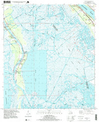
1995 Map of Lafitte
USGS Topo · Published 1999About this map
Lafitte serves as the focal point of this coastal landscape, situated along the curve of Bayou Barataria where it meets The Pen. The town’s history is anchored by a significant cluster of family and community burial grounds, including the Lafitte Cem, Coulon Cem, Fisher Cem, and Adams Cem, which provide a detailed record of local genealogy in this water-bound region. Education and infrastructure are noted by the presence of the Scottville Sch and Davis Sch, while the industrial character of the parish is defined by extensive drilling operations across the Barataria Oil and Gas Field and the Alliance Oil and Gas Field.
Find a feature on this map
48 named features on this map. Tap any name to fly to it.
Don’t see what you’re looking for? This feature index may not catch every label — zoom into the map to look around manually.
Map Details
Editions of this 1995 Lafitte Map
This is the sole edition of this map. No revisions or reprints were ever made.
Other maps of this area

1891 · Pointe a La Hache
USGS Topo · 1:62,500

1891 · New Orleans
USGS Topo · 1:62,500

1892 · Barataria
USGS Topo · 1:62,500

1892 · St. Bernard
USGS Topo · 1:62,500

1892 · Pointe a La Hache
USGS Topo · 1:62,500

1932 · New Orleans SE
USGS Topo · 1:31,680

1932 · New Orleans SW
USGS Topo · 1:31,680

1939 · Pointe a La Hache
USGS Topo · 1:62,500
1940 · Belle Chasse
USGS Topo · 1:31,680
1940 · Bertrandville
USGS Topo · 1:31,680