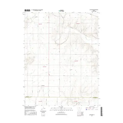
2015 Map of Lafontaine
USGS Topo · Published 2015About this map
Lafontaine serves as the primary settlement on this landscape, situated at the junction of State Hwy 39 and Grant Rd. The terrain is defined by the winding course of the Fall River, which meanders through the northern sections of the township, fed by tributaries including E Rainbow Cr and Sycamore Cr. The map reveals a highly structured grid of section lines and rural roads, such as Harper Rd and Jade Rd, which delineate the agricultural reaches of Wilson County. Local history is anchored by the Bachelder Cem in the northwest and Cheatham Cem further east, providing clear points of reference for genealogical research. The southern boundary of the map follows the Wilson Co Montgomery Co line, showing how the drainage of Mulberry Cr and Elm Br shapes the lower elevations of the quadrangle.
Find a feature on this map
46 named features on this map. Tap any name to fly to it.
Don’t see what you’re looking for? This feature index may not catch every label — zoom into the map to look around manually.
Map Details
Editions of this 2015 Lafontaine Map
This is the sole edition of this map. No revisions or reprints were ever made.
Other maps of this area

1886 · Fredonia
USGS Topo · 1:125,000

1886 · Independence
USGS Topo · 1:125,000

1894 · Fredonia
USGS Topo · 1:125,000

1894 · Independence
USGS Topo · 1:125,000

1905 · Independence
USGS Topo · 1:125,000

1938 · Fredonia
USGS Topo · 1:62,500

1938 · Altoona
USGS Topo · 1:62,500

1939 · Altoona
USGS Topo · 1:48,000

1939 · Fredonia
USGS Topo · 1:48,000

1942 · Fredonia
USGS Topo · 1:62,500