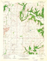
1963 Map of Lafontaine
USGS Topo · Published 1964About this map
The town of Lafontaine serves as a central hub in this early 1960s landscape, positioned near the border of Center, Talleyrand, and Louisburg townships. The area is defined by a sophisticated transportation network of both active and historical routes, including the Atchison Topeka And Santa Fe Railroad and an abandoned Old Railroad Grade that cuts diagonally across the terrain. These corridors follow the drainage patterns of the Fall River and its numerous tributaries, such as Duck Creek and Mulberry Creek.
Find a feature on this map
27 named features on this map. Tap any name to fly to it.
Don’t see what you’re looking for? This feature index may not catch every label — zoom into the map to look around manually.
Map Details
Editions of this 1963 Lafontaine Map
This is the sole edition of this map. No revisions or reprints were ever made.
Other maps of this area

1886 · Fredonia
USGS Topo · 1:125,000

1886 · Independence
USGS Topo · 1:125,000

1894 · Fredonia
USGS Topo · 1:125,000

1894 · Independence
USGS Topo · 1:125,000

1905 · Independence
USGS Topo · 1:125,000

1938 · Fredonia
USGS Topo · 1:62,500

1938 · Altoona
USGS Topo · 1:62,500

1939 · Altoona
USGS Topo · 1:48,000

1939 · Fredonia
USGS Topo · 1:48,000

1942 · Fredonia
USGS Topo · 1:62,500