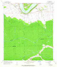
1962 Map of Lagan
USGS Topo · Published 1963About this map
Historic plantations along the Mississippi River anchor this early 1960s study of St. James Parish. The map documents a riverside landscape defined by its agricultural legacy and evolving industrial infrastructure, including the Bon Secours Plantation, Laurel Ridge Plantation, and the notable Oak Alley. Settlement follows the river's curve, where the Texas and Pacific railroad parallels the modern Levee system.
Find a feature on this map
46 named features on this map. Tap any name to fly to it.
Don’t see what you’re looking for? This feature index may not catch every label — zoom into the map to look around manually.
Map Details
Editions of this 1962 Lagan Map
4 editions found
Other maps of this area

1892 · Lac Des Allemands
USGS Topo · 1:62,500

1892 · Mount Airy
USGS Topo · 1:62,500

1892 · Donaldsonville
USGS Topo · 1:62,500

1892 · Thibodaux
USGS Topo · 1:62,500

1927 · Thibodaux NW
USGS Topo · 1:31,680

1932 · Lac Des Allemands NW
USGS Topo · 1:31,680

1932 · Lac Des Allemands SW
USGS Topo · 1:31,680

1932 · Thibodaux NE
USGS Topo · 1:31,680

1932 · Thibodaux SE
USGS Topo · 1:31,680

1932 · Thibodaux SW
USGS Topo · 1:31,680