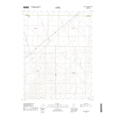
2018 Map of Lages Station
USGS Topo · Published 2018About this map
Lages Station serves as the primary landmark in this high-desert landscape where the Elko Co and White Pine Co line bisects the northern terrain. The geography is defined by the transition from the broad Steptoe Valley into the elevated reaches of the Schell Creek Range. This area is notably characterized by a high density of water sources in an otherwise arid environment, including Becky Springs and the Willow Spring Reservoir. The infrastructure reflects the evolution of Great Basin travel, with modern routes paralleling segments of Old US Hwy 93 Alt. Further south, the terrain becomes increasingly complex as it rises toward Water Canyon, supported by a network of isolated water points such as Moonshine Spring, Trough Spring, and Barrel Spring, which have historically sustained transit and ranching through these basins.
Find a feature on this map
23 named features on this map. Tap any name to fly to it.
Don’t see what you’re looking for? This feature index may not catch every label — zoom into the map to look around manually.
Map Details
Editions of this 2018 Lages Station Map
This is the sole edition of this map. No revisions or reprints were ever made.
Other maps of this area

1955 · Elko
USGS Topo · 1:250,000

1956 · Ely
USGS Topo · 1:250,000

1958 · Elko
USGS Topo · 1:250,000

1959 · Ely
USGS Topo · 1:250,000

1962 · Elko
USGS Topo · 1:250,000

1963 · Ely
USGS Topo · 1:250,000

1965 · Elko
USGS Topo · 1:250,000

1982 · Chin Creek Spring
USGS Topo · 1:24,000
1982 · Boone Canyon
USGS Topo · 1:24,000

1982 · Cherry Spring
USGS Topo · 1:24,000