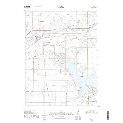
2019 Map of Lagro
USGS Topo · Published 2019About this map
Lagro sits at the confluence where the Wabash River meets the Salamonie River, a position that historically anchored this part of Wabash County. The landscape south of the town is heavily defined by the modern footprint of Salamonie Lake, which has significantly altered the drainage patterns of former tributaries like Rockaway Cr and Indian Cr. Local history is well-preserved through several established burial grounds, including Saint Patrick Cem and the Lagro Independent Order of Odd Fellows Cem.
Find a feature on this map
71 named features on this map. Tap any name to fly to it.
Don’t see what you’re looking for? This feature index may not catch every label — zoom into the map to look around manually.
Map Details
Editions of this 2019 Lagro Map
This is the sole edition of this map. No revisions or reprints were ever made.
Other maps of this area

1950 · Lagro
USGS Topo · 1:24,000

1950 · Andrews
USGS Topo · 1:24,000

1950 · Mount Etna
USGS Topo · 1:24,000

1951 · Mount Etna
USGS Topo · 1:24,000

1951 · Andrews
USGS Topo · 1:24,000

1951 · Lagro
USGS Topo · 1:24,000

1952 · Wabash
USGS Topo · 1:24,000

1953 · La Fontaine
USGS Topo · 1:24,000

1953 · Somerset
USGS Topo · 1:24,000

1953 · Muncie
USGS Topo · 1:250,000