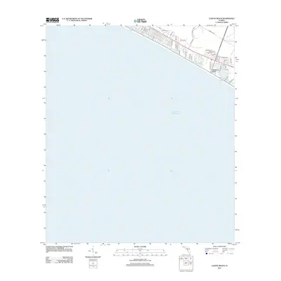
2012 Map of Laguna Beach
USGS Topo · Published 2012About this map
The coastal community of Gulf Resort Beach anchors the northeastern corner of this coastal survey, where residential development meets the white sands of the Gulf of Mexico. The landscape is defined by a dense grid of residential streets including Ashley Dr, Griffin Blvd, and San Vicente St, reflecting the suburban expansion of the Florida Panhandle in the early 21st century. To the north, the protected lands of the Point Washington WMA provide a sharp contrast to the coastal corridor, preserving the native vegetation and local ecology from the encroachment of vacation rentals and permanent residences. This record captures the intricate network of local ways such as Portside Dr and Power Line Rd that facilitate movement along this narrow strip of the Emerald Coast.
Find a feature on this map
38 named features on this map. Tap any name to fly to it.
Don’t see what you’re looking for? This feature index may not catch every label — zoom into the map to look around manually.
Map Details
Editions of this 2012 Laguna Beach Map
This is the sole edition of this map. No revisions or reprints were ever made.
Other maps of this area

1936 · Point Washington
USGS Topo · 1:48,000

1939 · Point Washington
USGS Topo · 1:62,500

1943 · Laguna Beach
USGS Topo · 1:31,680

1943 · Panama City Beach
USGS Topo · 1:31,680

1943 · Seminole Hills
USGS Topo · 1:24,000

1943 · West Bay
USGS Topo · 1:24,000

1944 · Seminole Hills
USGS Topo · 1:31,680

1944 · West Bay
USGS Topo · 1:31,680

1954 · Tallahassee
USGS Topo · 1:250,000
1955 · Panama City Beach
USGS Topo · 1:24,000
Featured Places
- Panama City Beach, FL
- Laguna Beach, FL
- Gulf Resort Beach, Panama City Beach
- Bay County, FL
- Walton County, FL