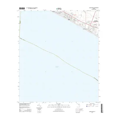
2015 Map of Laguna Beach
USGS Topo · Published 2015About this map
Laguna Beach and its neighboring coastal communities occupy a narrow strip of land along the Florida Panhandle, where the shoreline meets the vast Gulf of Mexico. This 2015 snapshot of the coastline illustrates a densely developed residential and resort corridor defined by its proximity to Front Beach Rd. The map tracks the expansion of Panama City Beach westward, showing how the grid of residential streets like Bonita Dr and Oleander Dr has filled the space between the highway and the sand. Further west, the map documents the established boundaries of Sunnyside and Gulf Resort Beach, emphasizing the continuous nature of beachfront development across the Walton and Bay County line. The transition from the open waters of the Gulf to the structured street plans reveals the intense focus on coastal accessibility and seasonal housing that characterizes this era of Florida's Gulf Coast history.
Find a feature on this map
56 named features on this map. Tap any name to fly to it.
Don’t see what you’re looking for? This feature index may not catch every label — zoom into the map to look around manually.
Map Details
Editions of this 2015 Laguna Beach Map
This is the sole edition of this map. No revisions or reprints were ever made.
Other maps of this area

1936 · Point Washington
USGS Topo · 1:48,000

1939 · Point Washington
USGS Topo · 1:62,500

1943 · Laguna Beach
USGS Topo · 1:31,680

1943 · Panama City Beach
USGS Topo · 1:31,680

1943 · Seminole Hills
USGS Topo · 1:24,000

1943 · West Bay
USGS Topo · 1:24,000

1944 · Seminole Hills
USGS Topo · 1:31,680

1944 · West Bay
USGS Topo · 1:31,680

1954 · Tallahassee
USGS Topo · 1:250,000
1955 · Panama City Beach
USGS Topo · 1:24,000
Featured Places
- Panama City Beach, FL
- Laguna Beach, FL
- Gulf Resort Beach, Panama City Beach
- Bay County, FL
- Walton County, FL