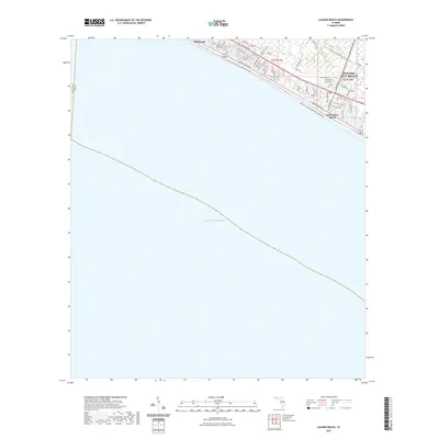
2021 Map of Laguna Beach
USGS Topo · Published 2021About this map
Panama City Beach and the neighboring coastal communities of Sunnyside and Gulf Resort Beach define this stretch of the Florida Panhandle. The landscape is characterized by a dense residential grid oriented toward the Gulf of Mexico, where major arteries like Front Beach Rd and E Co Rd 30A parallel the shoreline. This modern survey illustrates the extent of 21st-century coastal development, showing the transition between established beach neighborhoods and natural recreational corridors. Inland, the map documents a network of trails including the Great Nw Coastal Trail Corridor Trl and the State Road 79 Trl, which connect the beachfront to growing residential zones along Bay Pkwy and S Arnold Rd.
Find a feature on this map
48 named features on this map. Tap any name to fly to it.
Don’t see what you’re looking for? This feature index may not catch every label — zoom into the map to look around manually.
Map Details
Editions of this 2021 Laguna Beach Map
This is the sole edition of this map. No revisions or reprints were ever made.
Other maps of this area

1936 · Point Washington
USGS Topo · 1:48,000

1939 · Point Washington
USGS Topo · 1:62,500

1943 · Laguna Beach
USGS Topo · 1:31,680

1943 · Panama City Beach
USGS Topo · 1:31,680

1943 · Seminole Hills
USGS Topo · 1:24,000

1943 · West Bay
USGS Topo · 1:24,000

1944 · Seminole Hills
USGS Topo · 1:31,680

1944 · West Bay
USGS Topo · 1:31,680

1954 · Tallahassee
USGS Topo · 1:250,000
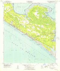
1955 · Panama City Beach
USGS Topo · 1:24,000
Featured Places
- Panama City Beach, FL
- Laguna Beach, FL
- Gulf Resort Beach, Panama City Beach
- Bay County, FL
- Walton County, FL