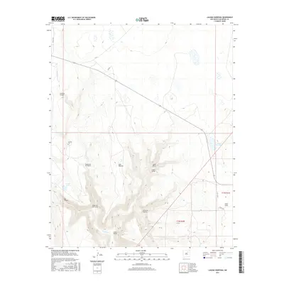
2017 Map of Laguna Huerfana
USGS Topo · Published 2017About this map
Jimenez Cem sits on a high terrace overlooking the upper reaches of the Conchas River, serving as a silent anchor for family history in this corner of San Miguel County. The landscape is defined by a dense network of drainage systems and narrow valleys, including Cañoncito de Mogote and the winding Cañon de las Cuevas, which slice through the high plains toward the riverbed. Isolated water sources like Conchas Spring and Crystal Lake provide critical points of relief in an otherwise arid terrain.
Find a feature on this map
23 named features on this map. Tap any name to fly to it.
Don’t see what you’re looking for? This feature index may not catch every label — zoom into the map to look around manually.
Map Details
Editions of this 2017 Laguna Huerfana Map
This is the sole edition of this map. No revisions or reprints were ever made.
Other maps of this area

1892 · Watrous
USGS Topo · 1:125,000

1892 · Corazon
USGS Topo · 1:125,000

1894 · Corazon
USGS Topo · 1:125,000

1894 · Watrous
USGS Topo · 1:125,000

1954 · Santa Fe
USGS Topo · 1:250,000

1958 · Santa Fe
USGS Topo · 1:250,000

1963 · Flagstone Mountain
USGS Topo · 1:24,000
1963 · Mesa Lauriano
USGS Topo · 1:24,000
1971 · Goetsch Lake
USGS Topo · 1:24,000

1971 · Laguna Huerfana
USGS Topo · 1:24,000