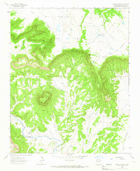
1963 Map of Mesa Lauriano
USGS Topo · Published 1966About this map
Mesa Lauriano and its surrounding plateau landscape define this mid-century topographic survey of San Miguel County. The land is characterized by steep-sided mesas and intricate drainage patterns, with the high ground of Mesa De Los Carros and Mesa Montosa overlooking the winding path of the Gallinas River. Human presence is marked by agricultural engineering and the remnants of earlier settlements along the valley floor. Researchers can trace the path of the Chaperito Ditch, an irrigation feature supporting the riverside lands, and identify old homestead sites such as Los Torres and San Lorenzo. These ruins, alongside the isolated Hatch Windmill and the settlement of Aguilar, suggest a transition in land use or a shift in population during the mid-20th century. The presence of a Jeep Trail ascending the mesa highlights the era's reliance on rugged transportation to navigate the complex terrain of Antonio Ortiz and the neighboring canyons.
Find a feature on this map
16 named features on this map. Tap any name to fly to it.
Don’t see what you’re looking for? This feature index may not catch every label — zoom into the map to look around manually.
Map Details
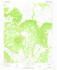
Editions of this 1963 Mesa Lauriano Map
2 editions found
Other maps of this area

1889 · Las Vegas
USGS Topo · 1:125,000

1890 · Bernal
USGS Topo · 1:125,000

1891 · Bernal
USGS Topo · 1:125,000

1891 · Las Vegas
USGS Topo · 1:125,000

1892 · Watrous
USGS Topo · 1:125,000

1892 · Corazon
USGS Topo · 1:125,000

1893 · Las Vegas
USGS Topo · 1:125,000

1894 · Corazon
USGS Topo · 1:125,000

1894 · Watrous
USGS Topo · 1:125,000

1894 · Bernal
USGS Topo · 1:125,000