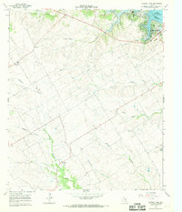
1966 Map of Laguna Park
USGS Topo · Published 1969About this map
Lake Whitney and its shoreline at Laguna Park anchor this Bosque County landscape, where the Brazos River system meets the varied topography of central Texas. The 1960s terrain is defined by several significant drainages, including the lengthy Childress Creek and Coon Creek, which carve through the elevations leading toward the lake. Small rural communities and landmarks suggest a settled ranching and agricultural economy, particularly around the Womack settlement and Cayote. Local history researchers will find several genealogy-rich points of interest, such as the Fairview Ch and the rural Cem near Womack. Along the lake's edge, Soldiers Bluff Park and its Bluff contrast with the industrial presence of Gravel Pits and various Water Tanks, illustrating the intersection of recreation, utility, and resource extraction during this era.
Find a feature on this map
20 named features on this map. Tap any name to fly to it.
Don’t see what you’re looking for? This feature index may not catch every label — zoom into the map to look around manually.
Map Details
Editions of this 1966 Laguna Park Map
This is the sole edition of this map. No revisions or reprints were ever made.
Other maps of this area

1888 · Meridian
USGS Topo · 1:125,000

1892 · Waco
USGS Topo · 1:125,000

1894 · Meridian
USGS Topo · 1:125,000

1920 · Waco
USGS Topo · 1:125,000

1924 · Waco 2-b
USGS Topo · 1:48,000

1931 · Whitney
USGS Topo · 1:62,500

1931 · Valley Mills
USGS Topo · 1:62,500

1954 · Waco
USGS Topo · 1:250,000

1955 · Waco
USGS Topo · 1:250,000

1955 · Clifton
USGS Topo · 1:24,000