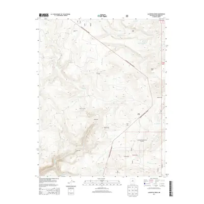
2013 Map of Lagunitas Creek
USGS Topo · Published 2013About this map
Carson National Forest terrain dominates this high-altitude landscape in northern New Mexico, where deep canyons and mountain water resources define the land use. The map reveals a high-country ranching network through a series of named outposts, including Stewart Cow Camp, Brazos Cow Camp, and the uniquely designated Thomas Martinez O'Reilly Cow Camp. These camps are situated near essential water sources such as Rio Brazos and Rio San Antonio, which carve through the topography. The dramatic Brazos Box and the desolate Bad Lands highlight the area's geological diversity. Water management is evident through numerous tanks like Jawbone Tank and Discovery Tank, supporting livestock across Olguin Mesa and through Cañon Manga. This survey provides a precise record of the traditional seasonal grazing grounds and the primitive forest roads that connect these remote mountain holdings.
Find a feature on this map
39 named features on this map. Tap any name to fly to it.
Don’t see what you’re looking for? This feature index may not catch every label — zoom into the map to look around manually.
Map Details
Editions of this 2013 Lagunitas Creek Map
This is the sole edition of this map. No revisions or reprints were ever made.
Other maps of this area

1918 · Tusas
USGS Topo · 1:125,000

1954 · Aztec
USGS Topo · 1:250,000

1955 · Cebolla
USGS Topo · 1:62,500

1955 · Brazos Peak
USGS Topo · 1:62,500

1958 · Aztec
USGS Topo · 1:250,000

1962 · Aztec
USGS Topo · 1:250,000
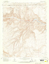
1963 · Bighorn Peak
USGS Topo · 1:24,000

1963 · Broke Off Mountain
USGS Topo · 1:24,000

1963 · Burned Mountain
USGS Topo · 1:24,000

1965 · Aztec
USGS Topo · 1:250,000