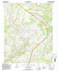
1995 Map of Lagunitas Creek
USGS Topo · Published 1997About this map
Tierra Amarilla Grant lands dominate this high-altitude landscape in Rio Arriba County, where the U.S. Forest Service and USGS documented the complex terrain during the 1990s. The map illustrates a seasonal pastoral economy through the presence of several isolated ranching outposts, including Stewart Cow Camp, Bywell Cow Camp, and the Thomas Martinez O'Reilly Cow Camp. These camps are connected by a network of high-clearance 4WD tracks that navigate around the Bad Lands and over Olguin Mesa.
Find a feature on this map
24 named features on this map. Tap any name to fly to it.
Don’t see what you’re looking for? This feature index may not catch every label — zoom into the map to look around manually.
Map Details
Editions of this 1995 Lagunitas Creek Map
This is the sole edition of this map. No revisions or reprints were ever made.
Other maps of this area

1918 · Tusas
USGS Topo · 1:125,000

1954 · Aztec
USGS Topo · 1:250,000

1955 · Cebolla
USGS Topo · 1:62,500

1955 · Brazos Peak
USGS Topo · 1:62,500

1958 · Aztec
USGS Topo · 1:250,000

1962 · Aztec
USGS Topo · 1:250,000
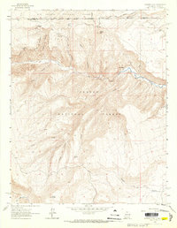
1963 · Bighorn Peak
USGS Topo · 1:24,000

1963 · Broke Off Mountain
USGS Topo · 1:24,000

1963 · Burned Mountain
USGS Topo · 1:24,000

1965 · Aztec
USGS Topo · 1:250,000