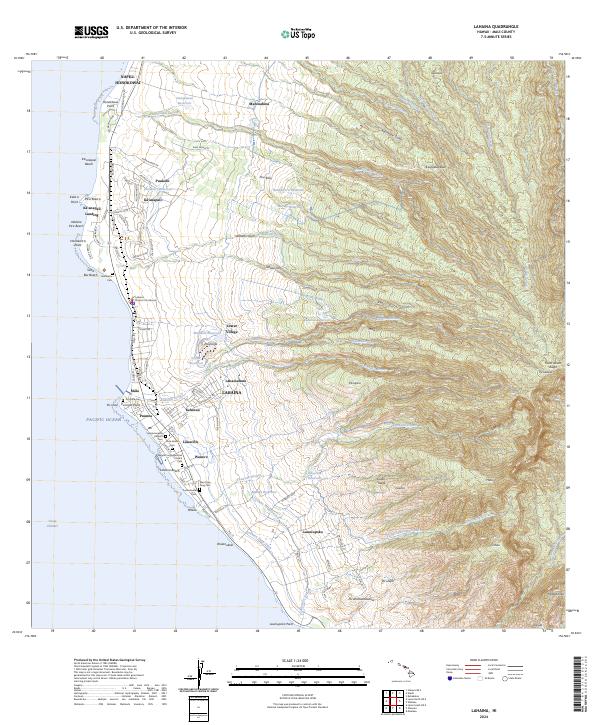
2024 Map of Lahaina
USGS Topo · Published 2024About this map
Lahaina serves as the focal point of this coastal Maui survey, situated where the steep volcanic ridges of Pu‘ukukui descend toward the Pacific Ocean. The settlement pattern follows the narrow coastal strip, with historical sites like the Lahaina District Courthouse and Lahainaluna anchored between the shore and the rising slopes. The map reveals a complex infrastructure for water management, including the Honokowai Ditch, Lahaina Pump Ditch, and numerous upland reservoirs like Wahikuli Reservoir and Kahoma Reservoir, which supported the agricultural and residential development of the region.
Find a feature on this map
119 named features on this map. Tap any name to fly to it.
Don’t see what you’re looking for? This feature index may not catch every label — zoom into the map to look around manually.
Map Details
Editions of this 2024 Lahaina Map
This is the sole edition of this map. No revisions or reprints were ever made.
Other maps of this area

1954 · Maui
USGS Topo · 1:250,000

1954 · Maalaea
USGS Topo · 1:24,000

1955 · Olowalu
USGS Topo · 1:24,000

1955 · Wailuku
USGS Topo · 1:24,000

1955 · Kahakuloa
USGS Topo · 1:24,000

1956 · Lahaina
USGS Topo · 1:24,000

1956 · Honolua
USGS Topo · 1:24,000

1966 · Maui
USGS Topo · 1:250,000

1974 · Maui
USGS Topo · 1:250,000

1977 · Wailuku
USGS Topo · 1:24,000