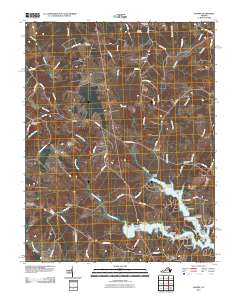
2010 Map of Lahore
USGS Topo · Published 2010About this map
Pamunkey Creek and its many tributaries, including Berry Run and Terrys Run, define the rural landscape of this region during the early 21st century. The map highlights the northern reaches of Lake Anna, where numerous residential points like Groomes Point and Woolfolk Point mark the modern development of the shoreline. Several historic communities are represented here, including Lahore, Tatum, and Monrovia, reflecting a settlement pattern that persists alongside quiet rural roads.
Find a feature on this map
79 named features on this map. Tap any name to fly to it.
Don’t see what you’re looking for? This feature index may not catch every label — zoom into the map to look around manually.
Map Details
Editions of this 2010 Lahore Map
This is the sole edition of this map. No revisions or reprints were ever made.
Other maps of this area

1887 · Spottsylvania
USGS Topo · 1:125,000

1892 · Spottsylvania
USGS Topo · 1:125,000

1892 · Gordonsville
USGS Topo · 1:125,000

1942 · Mineral
USGS Topo · 1:31,680

1942 · Lahore
USGS Topo · 1:31,680

1942 · Belmont
USGS Topo · 1:31,680

1942 · Contrary Creek
USGS Topo · 1:31,680

1943 · Mine Run
USGS Topo · 1:24,000

1943 · Unionville
USGS Topo · 1:24,000
1944 · Unionville
USGS Topo · 1:31,680