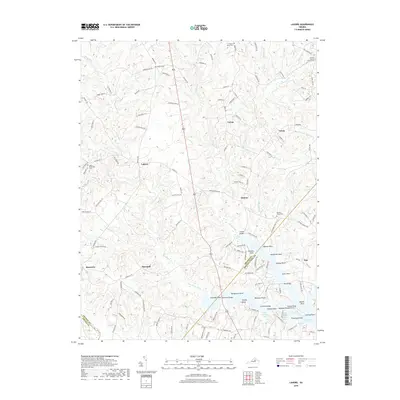
2019 Map of Lahore
USGS Topo · Published 2019About this map
Lake Anna dominates the southeastern quadrant of this 2019 survey, its winding shoreline forming numerous named points such as Conway Point and Dickersons Point. The landscape reflects a legacy of family landholdings and rural crossroads, where the borders of Orange, Spotsylvania, and Louisa Counties converge. Settlement patterns are defined by small communities like Lahore and Danton, often anchored by family cemeteries including Bethel Cem and the Antioch Baptist Church Cem.
Find a feature on this map
129 named features on this map. Tap any name to fly to it.
Don’t see what you’re looking for? This feature index may not catch every label — zoom into the map to look around manually.
Map Details
Editions of this 2019 Lahore Map
This is the sole edition of this map. No revisions or reprints were ever made.
Other maps of this area

1887 · Spottsylvania
USGS Topo · 1:125,000

1892 · Spottsylvania
USGS Topo · 1:125,000

1892 · Gordonsville
USGS Topo · 1:125,000

1942 · Mineral
USGS Topo · 1:31,680

1942 · Lahore
USGS Topo · 1:31,680

1942 · Belmont
USGS Topo · 1:31,680

1942 · Contrary Creek
USGS Topo · 1:31,680

1943 · Mine Run
USGS Topo · 1:24,000

1943 · Unionville
USGS Topo · 1:24,000
1944 · Unionville
USGS Topo · 1:31,680