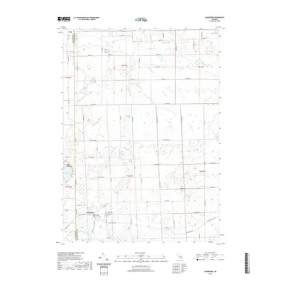
2019 Map of Laingsburg
USGS Topo · Published 2019About this map
Laingsburg and Ovid anchor this agricultural landscape along the border of Clinton and Shiawassee Counties. The region is defined by its complex drainage systems, where the Maple River flows through the northern reaches and the Looking Glass River winds near the southern boundary. Significant land use is dedicated to cemetery sites, including Mount Olivet Catholic Cem and Laingsburg Cem, which serve as vital points of interest for genealogical research in this part of Michigan. The settlement at Middlebury and the residential development surrounding Lake Victoria reflect the varied community structures that have evolved among the extensive rural acreage. A network of county roads like Grand River Rd and Simpson Rd connect these townships, tracing the historical paths through the wetlands and drains that characterize the local geography.
Find a feature on this map
76 named features on this map. Tap any name to fly to it.
Don’t see what you’re looking for? This feature index may not catch every label — zoom into the map to look around manually.
Map Details
Editions of this 2019 Laingsburg Map
This is the sole edition of this map. No revisions or reprints were ever made.
Other maps of this area

1917 · Chesaning
USGS Topo · 1:62,500

1918 · Elsie
USGS Topo · 1:62,500

1926 · Corunna
USGS Topo · 1:62,500

1928 · Laingsburg
USGS Topo · 1:62,500

1929 · Corunna
USGS Topo · 1:62,500

1943 · Chesaning
USGS Topo · 1:62,500

1943 · Elsie
USGS Topo · 1:62,500

1944 · Laingsburg
USGS Topo · 1:62,500

1944 · Corunna
USGS Topo · 1:62,500

1954 · Midland
USGS Topo · 1:250,000