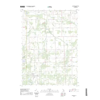
2023 Map of Laingsburg
USGS Topo · Published 2023About this map
The Looking Glass River and Maple River systems define this central Michigan corridor along the border of Clinton and Shiawassee Counties. The city of Laingsburg anchors the southern portion of the map, serving as a focal point for local history with its concentration of burial sites, including Laingsburg Cem and Mount Olivet Catholic Cem. To the north, the village of Ovid marks the edge of a landscape characterized by agricultural tracts and managed lands, such as the Farm Service Agency Interest of Michigan. Small tributaries and drainage networks like Putnam Drain and Alder Creek Drain weave through the township sections, illustrating the complex hydrology necessary for the region's farming economy. For genealogists, the distribution of rural cemeteries such as Putnam Cem and Middlebury Cem provides essential markers of early settlement patterns across the townships of Middlebury and Sciota.
Find a feature on this map
78 named features on this map. Tap any name to fly to it.
Don’t see what you’re looking for? This feature index may not catch every label — zoom into the map to look around manually.
Map Details
Editions of this 2023 Laingsburg Map
This is the sole edition of this map. No revisions or reprints were ever made.
Other maps of this area

1917 · Chesaning
USGS Topo · 1:62,500

1918 · Elsie
USGS Topo · 1:62,500

1926 · Corunna
USGS Topo · 1:62,500

1928 · Laingsburg
USGS Topo · 1:62,500

1929 · Corunna
USGS Topo · 1:62,500

1943 · Chesaning
USGS Topo · 1:62,500

1943 · Elsie
USGS Topo · 1:62,500

1944 · Laingsburg
USGS Topo · 1:62,500

1944 · Corunna
USGS Topo · 1:62,500

1954 · Midland
USGS Topo · 1:250,000