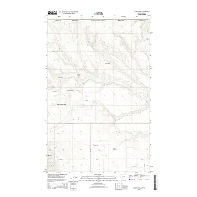
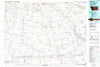
2014 Map of Laird School
USGS Topo · Published 2014About this map
Sage Creek Colony stands as a central landmark in this portion of Liberty County, situated north of the Keith Gas Field near the Canadian border. The landscape is defined by an intricate network of drainage channels, including Sage Cr, Laird Cr, and Simminook Cr, which carve through the terrain to form numerous named coulees such as Chicken Coulee, Coal Coulee, and Bobcat Coulee. These geographical features suggest a history of seasonal water management and localized resource extraction, further evidenced by the presence of the Turner Reservoir and the naming of Bears Den in the southwestern quadrant. A strictly gridded road system, including Flat Coulee Rd and Laird Rd, provides access across the townships of t37n r6e and t36n r6e, linking the Hutterite colony to the surrounding agricultural and industrial landscape.
Find a feature on this map
28 named features on this map. Tap any name to fly to it.
Don’t see what you’re looking for? This feature index may not catch every label — zoom into the map to look around manually.
Map Details
Editions of this 2014 Laird School Map
This is the sole edition of this map. No revisions or reprints were ever made.
Other maps of this area

1919 · Alma
USGS Topo · 1:125,000

1954 · Shelby
USGS Topo · 1:250,000

1958 · Shelby
USGS Topo · 1:250,000
1962 · Bingham Lake
USGS Topo · 1:24,000

1962 · Mount Lebanon
USGS Topo · 1:24,000

1963 · Bobcat Coulee SE
USGS Topo · 1:24,000

1963 · Vaver Reservoir
USGS Topo · 1:24,000
1964 · Bobcat Coulee NE
USGS Topo · 1:24,000
1964 · Laird School
USGS Topo · 1:24,000
1984 · Chester
USGS Topo · 1:100,000