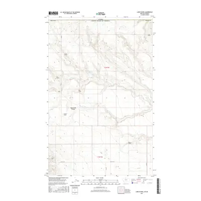
2017 Map of Laird School
USGS Topo · Published 2017About this map
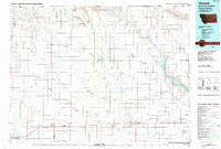
The northern edge of Liberty County, Montana, meets the international border in this 2017 survey of a high-plains landscape defined by seasonal watercourses and remote ranching infrastructure. Sage Creek Colony serves as a primary settlement point in this sparsely populated region, situated near the headwaters of Sage Cr. The terrain is deeply incised by numerous named drainages, or coulees, including Lost Coulee, Chicken Coulee, and Bobcat Coulee, which draw down toward the major creek beds. Institutional history is anchored by the Laird School at the junction of 1300 Rd E, while local water management is evidenced by the Turner Reservoir. Tracing the rural road network, including Bears Den Rd and Laird Rd, reveals the navigational structure of this frontier-like borderland at the start of the 21st century.
Find a feature on this map
22 named features on this map. Tap any name to fly to it.
Don’t see what you’re looking for? This feature index may not catch every label — zoom into the map to look around manually.
Map Details
Editions of this 2017 Laird School Map
This is the sole edition of this map. No revisions or reprints were ever made.
Other maps of this area

1919 · Alma
USGS Topo · 1:125,000

1954 · Shelby
USGS Topo · 1:250,000

1958 · Shelby
USGS Topo · 1:250,000
1962 · Bingham Lake
USGS Topo · 1:24,000

1962 · Mount Lebanon
USGS Topo · 1:24,000

1963 · Bobcat Coulee SE
USGS Topo · 1:24,000

1963 · Vaver Reservoir
USGS Topo · 1:24,000
1964 · Bobcat Coulee NE
USGS Topo · 1:24,000
1964 · Laird School
USGS Topo · 1:24,000
1984 · Chester
USGS Topo · 1:100,000