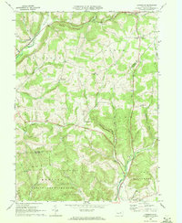
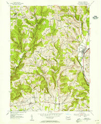
1968 Map of Lairdsville
USGS Topo · Published 1972About this map
Lairdsville and the surrounding borderlands of Lycoming and Columbia counties are captured here in a moment of rural stability during the late 1960s. The landscape is defined by the Muncy Hills and the winding course of Little Muncy Creek, which drains the northern reaches near Buck Ridge. The map reveals a dense network of local landmarks essential for genealogical research, including the Salem Ch and Germany Ch, along with family-named locations such as Ritters Crossroads and the Gardner Cem.
Find a feature on this map
47 named features on this map. Tap any name to fly to it.
Don’t see what you’re looking for? This feature index may not catch every label — zoom into the map to look around manually.
Map Details
Editions of this 1968 Lairdsville Map
3 editions found
Other maps of this area

1894 · Bloomsburg
USGS Topo · 1:62,500

1927 · Eagles Mere
USGS Topo · 1:48,000

1932 · Eagle Mere
USGS Topo · 1:62,500

1934 · Laporte
USGS Topo · 1:62,500

1935 · Hughesville
USGS Topo · 1:62,500

1947 · Bloomsburg
USGS Topo · 1:24,000

1947 · Benton
USGS Topo · 1:31,680
1953 · Bloomsburg
USGS Topo · 1:24,000
1953 · Benton
USGS Topo · 1:24,000

1953 · Hughesville
USGS Topo · 1:62,500
Featured Places
- Greenwood Township, PA
- Moreland Township, PA
- Pine Township, PA
- Unityville, Jordan Township
- Sereno, Pine Township