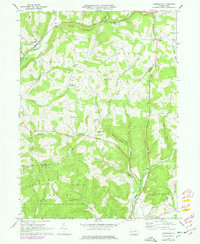
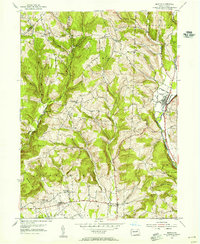
1968 Map of Lairdsville
USGS Topo · Published 1978About this map
The hills of Lycoming and Columbia counties transition into the forested ridges of Buck Ridge and Northside Ridge in this late-twentieth-century study. Small, rural villages such as Lairdsville and Unityville anchor a landscape defined by high-elevation farming and early-century infrastructure. The presence of numerous country churches and schools, including St Johns Ch and the Shoemaker Bridge Sch, suggests a series of tight-knit, ridge-top communities that remained largely intact through the 1970s. The southern portion of the area is dominated by the sprawling State Game Lands No 226, where the terrain drops toward Iola and Millville. Waterways like Little Muncy Creek and Little Fishing Creek carve deep valleys between the ridges, influencing the location of the few primary roads. Researchers can trace family-named landmarks such as Ritters Crossroads and the Gardner Cem, which provide glimpses into the nineteenth-century settlement patterns that persisted in these Pennsylvania highlands.
Find a feature on this map
46 named features on this map. Tap any name to fly to it.
Don’t see what you’re looking for? This feature index may not catch every label — zoom into the map to look around manually.
Map Details
Editions of this 1968 Lairdsville Map
3 editions found
Other maps of this area

1894 · Bloomsburg
USGS Topo · 1:62,500

1927 · Eagles Mere
USGS Topo · 1:48,000

1932 · Eagle Mere
USGS Topo · 1:62,500

1934 · Laporte
USGS Topo · 1:62,500

1935 · Hughesville
USGS Topo · 1:62,500

1947 · Bloomsburg
USGS Topo · 1:24,000

1947 · Benton
USGS Topo · 1:31,680
1953 · Bloomsburg
USGS Topo · 1:24,000
1953 · Benton
USGS Topo · 1:24,000

1953 · Hughesville
USGS Topo · 1:62,500
Featured Places
- Greenwood Township, PA
- Moreland Township, PA
- Pine Township, PA
- Unityville, Jordan Township
- Sereno, Pine Township