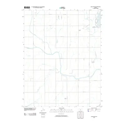
2009 Map of Lake Afton
USGS Topo · Published 2009About this map
The confluence of the North Fork Ninnescah River and South Fork Ninnescah River anchors this corner of Sedgwick County, where the plains are defined by a network of drainage creeks and rural section roads. The landscape is dominated by the Ninnescah River and its various tributaries, including Jocelyn Creek and Mud Creek, which cut through the agricultural grid. To the northeast, the recreation and institutional hub around Lake Afton provides a notable contrast to the surrounding farms, featuring the Lake Afton Boys Ranch and the organized layout of Quail Valley Ests. Local history and community markers are found in several pockets, such as the Peotone Cemetery in the southern portion and Camp Hyde along Clearwater Creek. Small-scale aviation is represented by Hovorka Airport, reflecting the region's connection to the aerospace-heavy culture of the nearby Wichita metropolitan area.
Find a feature on this map
36 named features on this map. Tap any name to fly to it.
Don’t see what you’re looking for? This feature index may not catch every label — zoom into the map to look around manually.
Map Details
Editions of this 2009 Lake Afton Map
This is the sole edition of this map. No revisions or reprints were ever made.
Other maps of this area

1889 · Cheney
USGS Topo · 1:125,000

1889 · Caldwell
USGS Topo · 1:125,000

1891 · Cheney
USGS Topo · 1:125,000

1893 · Caldwell
USGS Topo · 1:125,000

1897 · Caldwell
USGS Topo · 1:125,000

1901 · Cheney
USGS Topo · 1:125,000

1955 · Wichita
USGS Topo · 1:250,000

1958 · Wichita
USGS Topo · 1:250,000

1964 · Cheney
USGS Topo · 1:24,000

1965 · Garden Plain
USGS Topo · 1:24,000