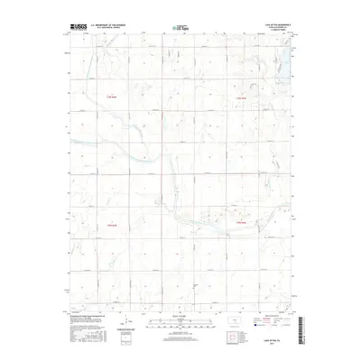
2015 Map of Lake Afton
USGS Topo · Published 2015About this map
The confluence of the North Fork Ninnescah River and South Fork Ninnescah River defines this rural landscape southwest of Wichita. These two major branches join to form the primary Ninnescah River in the eastern half of the map, a hydrological focal point that has historically shaped local land use and boundaries. North of this junction, Lake Afton serves as a significant recreational and water feature, flanked by Lake Afton Road and the residential area of Quail Valley Est. The terrain is characterized by numerous small drainages such as Sand Creek, Jocelyn Creek, and Clearwater Creek, which carve through the agricultural sections. For those researching local heritage, the Peotone Cemetery stands as a quiet marker of the area's early settlement history, situated among the grid of section-line roads like W 103rd St S and S 295th St W.
Find a feature on this map
38 named features on this map. Tap any name to fly to it.
Don’t see what you’re looking for? This feature index may not catch every label — zoom into the map to look around manually.
Map Details
Editions of this 2015 Lake Afton Map
This is the sole edition of this map. No revisions or reprints were ever made.
Other maps of this area

1889 · Cheney
USGS Topo · 1:125,000

1889 · Caldwell
USGS Topo · 1:125,000

1891 · Cheney
USGS Topo · 1:125,000

1893 · Caldwell
USGS Topo · 1:125,000

1897 · Caldwell
USGS Topo · 1:125,000

1901 · Cheney
USGS Topo · 1:125,000

1955 · Wichita
USGS Topo · 1:250,000

1958 · Wichita
USGS Topo · 1:250,000

1964 · Cheney
USGS Topo · 1:24,000

1965 · Garden Plain
USGS Topo · 1:24,000