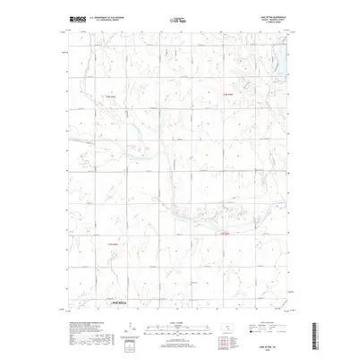
2018 Map of Lake Afton
USGS Topo · Published 2018About this map
Lake Afton and the surrounding drainage basin of the Ninnescah River define this rural landscape west of Wichita. The map details the convergence where the North Fork Ninnescah River and South Fork Ninnescah River meet, forming a complex network of tributaries including Clearwater Cr, Mud Cr, and Sand Cr. This hydrology has long dictated the layout of local infrastructure and settlement patterns in Sedgwick County.
Find a feature on this map
40 named features on this map. Tap any name to fly to it.
Don’t see what you’re looking for? This feature index may not catch every label — zoom into the map to look around manually.
Map Details
Editions of this 2018 Lake Afton Map
This is the sole edition of this map. No revisions or reprints were ever made.
Other maps of this area

1889 · Cheney
USGS Topo · 1:125,000

1889 · Caldwell
USGS Topo · 1:125,000

1891 · Cheney
USGS Topo · 1:125,000

1893 · Caldwell
USGS Topo · 1:125,000

1897 · Caldwell
USGS Topo · 1:125,000

1901 · Cheney
USGS Topo · 1:125,000

1955 · Wichita
USGS Topo · 1:250,000

1958 · Wichita
USGS Topo · 1:250,000

1964 · Cheney
USGS Topo · 1:24,000

1965 · Garden Plain
USGS Topo · 1:24,000