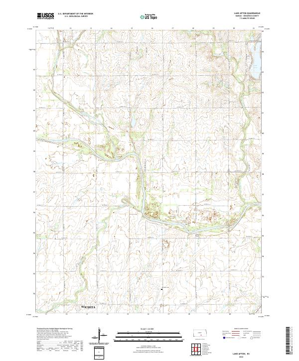
2022 Map of Lake Afton
USGS Topo · Published 2022About this map
The confluence of the North Fork Ninnescah River and South Fork Ninnescah River defines the lower half of this landscape west of Wichita. This area of Sedgwick County is a network of prairie waterways, where the main stem of the Ninnescah River takes shape and winds eastward. The northern reaches are punctuated by Sunnebuhl Lake and the significant recreation area surrounding Lake Afton, while the southern portion features the Peotone Cem, a quiet marker of the region's rural genealogy. Numerous tributaries, including Clearwater Cr, Afton Cr, and Sand Cr, drain the sectioned farmland, following a rigid grid of country roads such as W 47th ST S and S 327th ST W. This map illustrates the transition from the suburban edge of the city to the structured agricultural plains that sustain the local economy.
Find a feature on this map
41 named features on this map. Tap any name to fly to it.
Don’t see what you’re looking for? This feature index may not catch every label — zoom into the map to look around manually.
Map Details
Editions of this 2022 Lake Afton Map
This is the sole edition of this map. No revisions or reprints were ever made.
Other maps of this area

1889 · Cheney
USGS Topo · 1:125,000

1889 · Caldwell
USGS Topo · 1:125,000

1891 · Cheney
USGS Topo · 1:125,000

1893 · Caldwell
USGS Topo · 1:125,000

1897 · Caldwell
USGS Topo · 1:125,000

1901 · Cheney
USGS Topo · 1:125,000

1955 · Wichita
USGS Topo · 1:250,000

1958 · Wichita
USGS Topo · 1:250,000

1964 · Cheney
USGS Topo · 1:24,000

1965 · Garden Plain
USGS Topo · 1:24,000