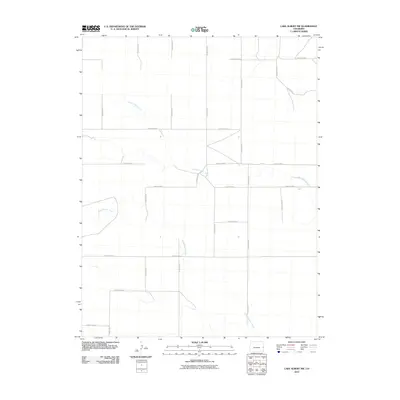
2010 Map of Lake Albert NW
USGS Topo · Published 2010About this map
South Ladder Creek and White Woman Creek define the drainage of this high plains landscape in Cheyenne County. This 2010 survey by the U.S. Geological Survey shows a stark, grid-like infrastructure typical of the region's agricultural development. The terrain is partitioned by a meticulous network of rural transit lines, including primary routes like County Hwy G and secondary arteries such as County Road H and County Road F. These roads follow the section lines of the Public Land Survey System, illustrating how human settlement and land management have been imposed upon the natural winding courses of the creek beds. For those studying the rural layout of eastern Colorado, this map provides the exact positioning of county-maintained infrastructure at the beginning of the decade.
Find a feature on this map
18 named features on this map. Tap any name to fly to it.
Don’t see what you’re looking for? This feature index may not catch every label — zoom into the map to look around manually.
Map Details
Editions of this 2010 Lake Albert NW Map
This is the sole edition of this map. No revisions or reprints were ever made.
Other maps of this area

1892 · Cheyenne Wells
USGS Topo · 1:125,000

1894 · Cheyenne Wells
USGS Topo · 1:125,000

1954 · Lamar
USGS Topo · 1:250,000

1958 · Lamar
USGS Topo · 1:250,000

1969 · Arapahoe SE
USGS Topo · 1:24,000

1969 · Cheyenne Wells 4 NE
USGS Topo · 1:24,000
1969 · Cheyenne Wells 4 SE
USGS Topo · 1:24,000

1981 · Cheyenne Wells
USGS Topo · 1:100,000
1982 · Cheyenne Wells
USGS Topo · 1:24,000
1982 · Lake Albert
USGS Topo · 1:24,000